How John Wood found Quincy
How was it that emigrant John Wood decided to abandon his initial plan to settle in the Tennessee River Valley and make his way to the place along the Mississippi River, which would become Quincy?
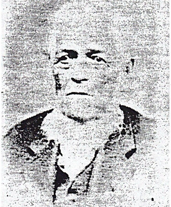
Wood was just shy of 20 years old when on Nov. 2, 1818, he left his Sempronius, N.Y., home to make his mark on the world. Although he was in the vanguard of the emerging westward migration by adventurous easterners, Wood had chosen to go south instead of west. He told Quincy lawyer and historian Henry Asbury that he initially considered settling in the Tennessee River Valley in Northern Alabama. Wood made it as far as Cincinnati by the time of his first winter away from New York. During that winter of 1818-1819, Wood revised his destination and continued on a westward course along the Ohio River. The Ohio was the southern boundary of the Northwest Territory. By its "Northwest Ordinance" of 1787, Congress prohibited slavery from the territory and states that would be formed from it: Ohio, Indiana, Illinois, Michigan, and Wisconsin. At the time of Wood's journey, the Union's slave states, including Alabama, were situated south of the Ohio.
The prohibition of slavery in the northwest would have suited Wood. Sempronius had been at the eastern edge of the "Burned Over District." There in western New York were held great religious gatherings, part of the "Second Great Awakening," a revivalist movement that drew thousands of converts beginning in the early 1800s. Innovative preachers told worshippers they could achieve their own salvation through good works. And reform movements advocating women's rights, temperance, and abolition, developed.
When Wood left Cincinnati in early 1819, he set his course directly for Illinois, which on Aug. 26, 1818, had become a free state. He spent the summer of 1819 in Shawneetown, where the Ohio meets Illinois' southeastern shore. Shawneetown's attraction was that it was the federal administrative center, including a federal land office and the first bank chartered in the Illinois Territory in 1812. Land and the capital to buy it were available at this single location.
By the time of Wood's arrival in Illinois in 1819, several travel and guide books for emigrants into the northwest had been published. Among the most popular was Morris Birkbeck's "Notes on a Journey in America," which had been published in 1817 and already had gone through 11 printings, and Birkbeck's "Letters from Illinois," which had similar success. Birkbeck and fellow English Utopian George Flower, bringing their significant wealth with them, bought huge tracts of land in Edwards County in eastern Illinois and extolled the advantages of settlement in the area around the towns of Albion and Wanborough, which they founded. Birkbeck's book attracted many settlers to the state's eastern prairie.
Wood, however, chose to continue his westward journey, hiking across Illinois and spending the winter of 1819-20 in Madison County. There, at Edwardsville, he met two men who would figure prominently in his future: Federal land Register Edward Coles, a Virginian who had freed his slaves enroute to Illinois, and fellow emigrant Willard Keyes, a Vermont native. Elected governor in 1822, Coles led the struggle -- and recruited Wood's help in the Military Tract -- against an attempt between 1822 and 1824 to make Illinois a slave state. The issue was defeated, and Wood considered his role in the fight his life's greatest accomplishment.
Some local histories credit Keyes, who had passed the site before Wood saw it, with stirring Wood's interest in the limestone bluffs over the Mississippi. Yet Keyes in his journal, now in the Historical Society's collection, made no mention of the location at the time he passed it while rafting from Prairie du Chien, Wis., to St. Louis in 1819. Keyes had recorded information about numerous other locations and stops, including Lt. Zebulon Pike's fort near the confluence of the Wisconsin and Mississippi Rivers, the Dubuque lead mines, Maj. (and future president) Zachary Taylor's Fort Edwards (today's Warsaw), and Hannibal, Louisiana, and Clarksville, Mo. But he entered nothing about the bluffs that jutted out from Illinois' westernmost point into the Mississippi as he passed.
Keyes took a hiatus from his journal after July 29, 1819. When he resumed writing on August 21, 1821, he included a synopsis of activities in the intervening years. It was then that he squeezed in an entry, which he italicized, "Pass the site of Quincy May 10, 1819." By the time Keyes wrote that, he and Wood had been partners for more than a year, squatting on land they did not own near today's New Canton in Pike County. They harvested three crops in their two years there.
Keyes recorded that he and Wood acquired maps, charts, and field notes of the bounty lands in the Illinois Military Tract, which they used to help veterans of the War of 1812 locate their quarter section of land. The partners earned $1 a day for their service.
In his book, "River Towns of the Great West," historian Timothy R. Mahoney indicates that the maps and charts Wood used had been compiled by Edmund Dana, who had resided and surveyed lands of the Military Tract after its creation on Dec. 24, 1811. By 1819, Dana published two books, the first, "A Description of the Bounty Lands in the State of Illinois," and the second, "Geographical Sketches on the Western Country: Designed for Emigrants and Settlers."
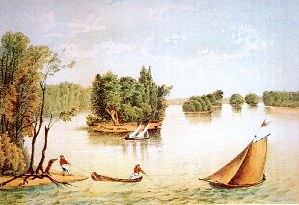
In them Dana described the bluffs over the Mississippi and its geographical features as ideally suited for an important settlement. Its soil, Dana wrote, was "first rate" for farm land, supplied with good water, drainage, and timber. Dana described streams, cascades, and falls suitable for mill seats. The section that would become Quincy was on a "high, dry, charming surface, suitable for a town site and ferry, and supplied with copious springs of good water."
Dana saw other attractions in the location.
"To the position of this spot, a considerable importance is attached, in the opinion of the author, and of those who traversed that range, from its being the point most convenient for crossing the Mississippi, in a route from the Sangamo country to that extensive region of valuable lands, in the direction of the Boon's Lick and Salt river settlements in Missouri."
Roads west, Dana noted, would have to pass through the site to avoid "the miry bottoms near the river and bad water courses and high rugged hills towards the Illinois." The location was not only convenient for a ferry landing, but a full day north of St. Louis by river, making it ideal as a stop and supply depot for river traffic."
Both of Dana's books were published in Cincinnati in 1819 at the time Wood wintered there.
The law creating the bounty land worked in Wood's behalf since it would not be open to public purchase until 1830. In the meantime, only war veterans and speculators who bought their land had access to ownership. And most veterans had no interest in moving to the primitive west from established homes in the east. The number of land sales in the Military Tract demonstrate Wood had little competition for it before 1830.
Their business positioned Wood and Keyes to select and buy land. They offered to locate and assess properties for veterans who wanted information before deciding to keep or sell it. The ploy worked for Wood from his first acquisition in what would become Quincy. Land speculator Peter Flinn hired Wood to help him locate Flinn's property. When Wood escorted Flinn to his land -- at the site Edmund Dana had praised, Flinn considered it too far from civilization. He offered to sell it to Wood, who would pay no more than $60 cash for it. Flinn rejected Wood's offer.
But with no other prospects over the following year, Flinn sold it to Wood for $60 on Nov. 19, 1822. Historian Mahoney writes that it was Dana's descriptions of the singular attributes of this place on the Mississippi that led Wood to buy it.
Reg Ankrom is a member of several history-related organizations, the author of a biography of Stephen A. Douglas of Quincy, and a frequent speaker on pre-Civil War history.
Sources
Asbury, Henry. Reminiscences of Quincy, Illinois. Quincy, Illinois: D. Wilcox & Sons, 1882.
Birkbeck, Morris. Notes on a Journey in America from the Coast of Virginia to the Territory of
Illinois. London: Severn and Co., 1818.
Collins, William H. and Cicero F. Perry. Past and Present of the City of Quincy and Adams
County, Illinois. Chicago: The S.J. Clarke Publishing Co., 1905.
Dana, Edmund. A Description of the Bounty Lands in the State of Illinois. Cincinnati: Looker,
Reynolds & Co., 1819.
----------. Geographical Sketches on the Western Country: Designed for Emigrants and
Settlers. Cincinnati: Looker, Reynolds & Co., 1819.
Mahoney, Timothy R. River Towns in the Great West: The structure of provincial urbanization
in the American Midwest, 1820-1870. New York: Cambridge University Press, 1990.
Richardson, William A. Jr. "The Founders of Quincy, Illinois--John Wood, Willard Keyes,
Jeremiah Rose." Journal of the Illinois Historical Society, vol. 17. Springfield, Illinois:
Illinois State Historical Society, 1924.